Thursday, January 29, 2009

Trip to Organ Pipe Cactus National Monument


Here is Sandy getting ready to jump into the truck so we can head down to the Organ Pipe Cactus National Monument. This park is about 150 miles south of Phoenix on the Mexican border.


As we were getting ready to leave on our small adventure, several dozen people were taking off on their high adventure in 5 hot air balloons. They were taking off at a launch site about 1 mile south of the park, so pulled over and took a few pictures. We have never been in a hot air balloon, but pehaps we should put it on our “Bucket List”.


When we stopped at McDonald's for a quick breakfast this old relic was sitting out front. It’s a 1928 Ford. Sandy got it right when she said “this should be kept just as it is and not be restored”. It was called "The Old Ratter".


At the Park entrance there was another couple , so we did the you take ours and we’ll take yours routine.


At the south end of the park is a border crossing. This is the same crossing our friends from Quartzsite crossed going to Puerto Penasco, Mexico.


Here is the road map of the 22 mile road called Ajo Mountain Drive. This is the only drive open at this time. The other road bordering Mexico is closed indefinitely.


This is a picture of the fence that is being built along the border.


This Saguaro seems to be saying "come here and let me give you a hug".


Most of the road is one way, thankfully. About 2/3 is dirt and the rest is paved.


Here are a couple of Chain-Fruit Cholla pictures.


Another thing you see are Touristos, AKA as my wife.


Now HERE is a Organ Pipe Cactus


Here are several photos taken along the road.


This picture shows a Saguaro Cactus skeleton with a "shoe" sticking out the right side. A "shoe" is where a bird has hollowed out a nest and the cactus has healed itself by forming a cork-like scare tissue.


Here is a photo of a young Saguaro Cactus growing in a young Organ Pipe Cactus.


Now why would you name a town Why?


Bye for now,
Dave and Sandy

Monday, January 26, 2009

Back in Phoenix

Friday, the day after we got back was a busy day as Sandy cleaned the inside of the motorhome because of all the dust we had in Quartzsite and washed 6 loads of clothes. While Sandy was doing that I ran the California duster over the motorhome and cleaned the bugs off the front of the motorhome. At 5:00 we went over to Mary Jo and Mike’s for happy hour. Mary Jo and Mike had invited Jane, Ron and us for a supper which consisted of a 7 layer salad, homemade vegetable beef stew, corn bread and dessert which was peach and strawberry sorbet with fresh peaches, strawberries and blueberries from back home in Illinois as topping. Way to good!


On Saturday morning Sandy mentioned that we should take a road trip and go on the Apache Trail but the weather looked like it could still rain so we started the day by going to breakfast at Harold’s in Cave Creek. It was a little after 11:00 when we finished and came outside to see that the weather had changed for the better, so we decided to give the Trail a try. The first problem is that the start of the Trail is an hour away at the intersection of US 60 and AZ HWY 88. Then the second problem is that although the Apache Trail is only 48 miles long, 22 miles of it are gravel, and a lot of that is single lane with pullouts for opposing traffic. We ended up not stopping at Goldfield, supposedly a ghost town but now rather commercialized, and the town of Tortilla Flat also rather commercialized. This turned out to be the right decision as we still had good sunlight when we got to the end at Roosevelt Lake.


The Apache Trail starts with a view of the Superstition Mountains


A couple of miles up the road is Goldfield, but we did not stop here. At about twenty miles on the Trail the road pretty much follows the Salt River.


Some beautiful scenery along the way.


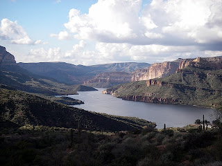
The first reservoir that we came to was Canyon Lake which is one of four dams on the river, three of which we will see.


Some more scenery along the way.


After about 26 miles on the trail we came to the start of the dirt road.


Here are some pictures while on the dirt road.


Then next lake we came to was Apache Lake.


The third and final lake we came to was Theodore Roosevelt Lake and dam. This dam was made of bricks in 1911 and remains the world’s largest masonry dam at almost 300 feet tall.


This is a picture of Roosevelt Lake and the bridge they built to divert traffic off the bridge to do repairs.


If you ever get to the Phoenix area, this is a trip worth taking, but give it a full day so you can stop at the Goldfield and especially Tortilla Flat (which we did not because of time constrants). The road also connect to AZ HWY188 leading up to Payson which is also a very scienic area. That trip will have to wait for another day.

Until next time,
Dave and Sandy