We’re on the road again. We headed out on Wednesday the 24th of August to the Grand Tetons to spend a week with our friends Ron and Jane from Scottsdale. As a bonus Gil and Nancy from Henderson, Nevada will be there for the first couple of days we are there. We left home and put in a long day getting to Lusk, WY for our over night stop. We wanted to get into the Tetons early the second day so the first day we drove 726 miles in 13 ½ hours. We drove US 169 to MN 60 through SW Minnesota where we picked up I-90 west to Murdo, SD. Sandy took over the driving from Murdo and headed south on US 83 to US 20 at Valentine, Nebraska. Dave was able to relax during this time to take a short nap. We headed west to Lusk, WY where we spent the night. We’ve got to come back to Nebraska and spend some time in the Sand Hills and Chadron areas.
The second day we drove 391 miles and it took us 10 hours because we got bogged down with road construction for the last 40 miles. We had several stretches where we had to wait for pilot cars to lead us through---so much for the “getting in early idea”. We stopped at Riverton, WY to wash off all the grasshoppers and honeybees we picked up driving through South Dakota and Nebraska. Little did we know the bugs would soon be replaced by dust and mud from road construction.
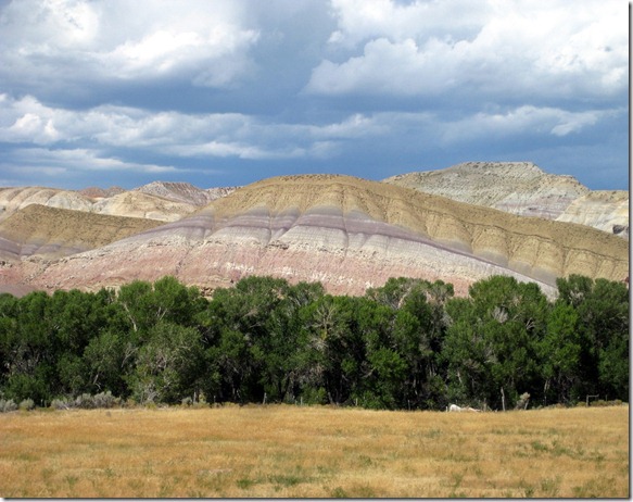
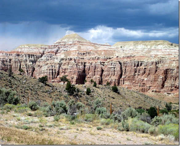
This interesting stratification is along the North Fork of the Wind River going NW on US 26/287 out of Riverton, WY.
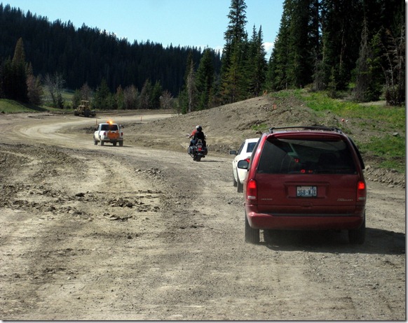
 We had a long wait at this construction stop. Three bicyclists showed up while we were stopped. They talked with the person holding the sign who kept shaking her head “no”. A little while later a supervisor showed up and they kept talking with the bicyclist. Finally a couple of pickups came but the bicyclist kept talking and the road crew people keep indicating they should put their bikes in the pickups. I’m sure the road crew won out because we drove through 17 miles of construction and there were sections much worse than we show here. I do know that the bicyclists take pride in having ridden every mile of the trip so they were reluctant to take the “shuttle ride”. The ride would have been extremely difficult and dangerous on bikes. The motorcyclists made it through, but they drove through a lot of dust and mud.

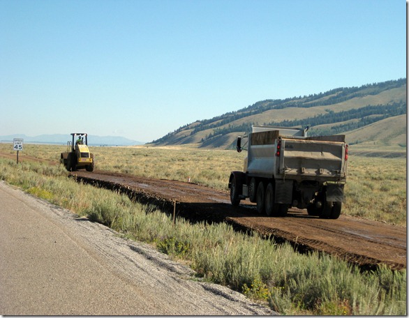
 These guys sure get a day’s work in. I am surprised they don’t use dynamite.

 We arrived at Gros Ventre Campground at about 5 PM on August 25th. We spent the next day relaxing and reading and we all got together for supper with Gil, Nancy, Ron and Jane. Ron and Gil grilled scrumptious pork tenderloins. Jane made her special sweet potatoes and Nancy served cole slaw and juicy watermelon for dessert. Mmmm good.
Dave, Sandy, Nancy, “movie star” Jane with the shades, Gil and Ron.
We arrived at Gros Ventre Campground at about 5 PM on August 25th. We spent the next day relaxing and reading and we all got together for supper with Gil, Nancy, Ron and Jane. Ron and Gil grilled scrumptious pork tenderloins. Jane made her special sweet potatoes and Nancy served cole slaw and juicy watermelon for dessert. Mmmm good.
Dave, Sandy, Nancy, “movie star” Jane with the shades, Gil and Ron.
 Now, behind every good picture there has to be a director with many retakes.
 Here Ron and Gil are doing a superb job on the pork tenderloins.
 Later in the evening Sandy took this picture of clouds facing east with the sunset reflecting from the west. Parts of the clouds are actually smoke from the wildfire burning about 10 miles east of the campground.
 Our visit time with Gil and Nancy was too short as they had to leave on Saturday and head back home.
 Here in the campground we generally see moose in the early mornings between 6:30 and 7:30. It’s interesting to watch how they strip the leaves off the young willows. Sorry for all the background clutter but the moose wasn't interested in posing in a better location.

 This is what Sandy and I get to see every day out our rear window. That is the Grand Teton in the far left background peaking over the hill.
 Jane is real happy as the park is putting in a bicycle riding path along the road that will hook up to an existing path further north in the park. I’m sure both cyclists and motorists will appreciate this.
 Here is a Speyeria Coronis butterfly which looks a lot like a Monarch butterfly but smaller.
 One day Jane wanted to take a little bike ride so we agreed to meet up with her and have lunch by String Lake. When I looked at her odometer and saw that it read a little over 16 miles I was glad I didn't take her up on the offer to ride with her on their other bike.

 After a picnic lunch we all took a hike up to Leigh Lake. Below is a picture of String Lake which we hiked by on our way to Leigh Lake.
 While hiking, we encountered a pine marten that followed parallel to us for about 1/8 of a mile. Thanks to Jane for these excellent action photos. Believe me, we were not as close as these photos imply.


 Here are Ron, Sandy and I at the Leigh Lake end of a portage which runs from String Lake to Leigh Lake.
 This is me at the same portage with Mt. Moran in the background.
 Here are Sandy and I with Mt. Moran in the background.
 We thought it would be interesting to take a picture showing the contrast between a “classic” and a “modern” paint scheme of a Lazy Daze in the same color.
 Tetons part 2 coming to your local computer soon!!
Until next time,
Dave and Sandy
Tetons part 2 coming to your local computer soon!!
Until next time,
Dave and Sandy
After spending the night in North Platte, NE we headed north on US 83 through the Sand Hills region. We have driven through the Sand Hills a couple of times before and have always thought we should stop and spend some time here. It is interesting that these sand dunes are covered with grass and there are lots of pockets of water and several lakes. Though not as majestic as the rocky mountains they are beautiful and interesting.
Dunes in the Sand Hills may exceed 330 ft. in height. The average elevation of the Sand Hills region gradually increases from about 1,800 ft. in the east to about 3,600 ft. in the west. The dunes were the end result of the last ice age known as the Pinedale glaciation.
The Sand Hills sit atop the massive Ogallala Aquifer; thus both temporary and permanent shallow lakes are common in low-lying valleys between the grass-stabilized dunes prevalent in the Sand Hills. This provides lots of habitat for ducks and geese that use the area for nesting and for stopping on their migration.
The fragility of the sandy soil makes the area unsuitable for cultivation of crops. Unsuccessful attempts at farming were made in the Sand Hills region in the late 1870s and again around 1890. Some development of cropland agriculture in the modern era has occurred through the use of center-pivot irrigation systems.
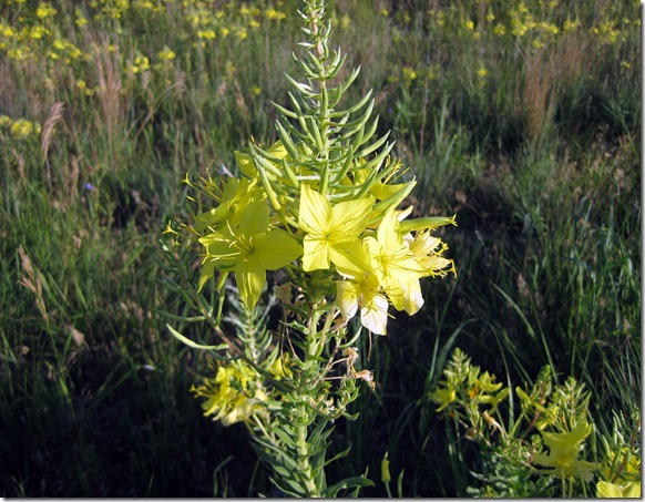
There were miles and miles of the Yellow Evening Primrose along the right of way of the highway.
 We came upon this group of cattle being moved from one pasture to another. We wondered how far they were moved.
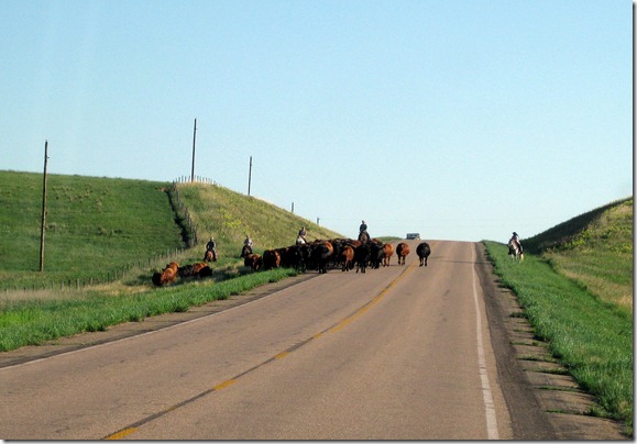
 Cowboys with their trusty canine helpers. These cattle dogs have amazing herding instincts.


 It’s interesting to see how many windmills are still in use.


 Sandy’s sister’s husband’s first job with the U.S. Fish and Wildlife Service was at the Valentine National Wildlife Refuge. After he married Cindy, John went on to manage the Waubay NWR and then the Sand Lake NWR.


 Getting closer to home as we enter South Dakota north of Valentine, NE. and headed to Sandy’s folks in Aberdeen, SD.
 As we crossed the Missouri River at Fort Thompson we found the river still to be at flood stage. It’s hard to believe that just a few years ago some stretches were almost back to the old river channel size before the dams were put in.

 We spent a couple of days in Aberdeen visiting with Sandy’s folks, sister and brother-in-law. Here is Sandy’s dad doing what he likes best--working-- no, playing in the garden. This is where Sandy gets her love of flowers. She just does not like playing--no that’s working in the dirt. Here are some of the results of his labor. He's 86 and still going strong.


 Here are Sandy’s parents, Dalles and Erwin.
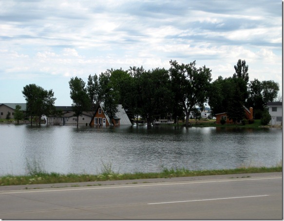
 We left Aberdeen and drove on US Hwy 12 east of Aberdeen through the Waubay area. Water levels in this area have been steadily rising for some reason over the last few years on this glacial coteau. Here are a couple pictures of flooded lake homes on Blue Dog Lake. Many farms, homes and small towns are being flooded out. Sandy has a friend from her home town in South Dakota who said that some of the houses on Blue Dog Lake are selling for $1. The houses are ruined, of course, but someone must be betting the water will recede some day. Flooding has also closed US Hwy 12 west of Aberdeen for most of the summer.
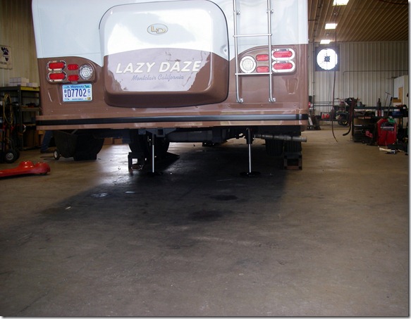
 On Sunday the 24th I drove to White Pigeon, MI to have Big Foot levelers installed on the motorhome. When I got out there I spent the night in their parking lot and by 8:00 they had me in the shop where two young men attacked it from both ends. It took them about 3 ½ hours to finish the job.


 After they finished up around 11:30 I headed back the 539 miles to home. Along the way I decided to just drive straight though. Here is a sunset picture I was able to take driving back.
 We have been busy doing modifications to the motorhome and spending a lot of time arranging and rearranging where we are going to keep stuff in the motorhome. It seems as if we have a lot of stuff that we took out of the old MH that will not fit into the new one. But I guess that’s not surprising as the new one could fit into the kitchen and living room area of the old MH.
Until next time,
Dave and Sandy
We have been busy doing modifications to the motorhome and spending a lot of time arranging and rearranging where we are going to keep stuff in the motorhome. It seems as if we have a lot of stuff that we took out of the old MH that will not fit into the new one. But I guess that’s not surprising as the new one could fit into the kitchen and living room area of the old MH.
Until next time,
Dave and Sandy


