8-26-12 & 8-27-12
Today, Sunday the 26th, we are headed to Lolo, MT which is just southwest of Missoula where we can ride the motorcycle west on US 12 through the Clearwater Mountains. US 12 runs 101 miles through the Clearwater and Bitterroot National Forest and along the Lochsa River with only one town along the way. I had ridden it on a motorcycle in 2009 and wanted Sandy to see it.
Much to Sandy’s dismay, I have not lost my ability to find roads that are narrow and curvy. This one is Montana Hwy 49 that is a short cut coming from St Mary to catch US Hwy 2 west that runs along the south side of Glacier National Park.
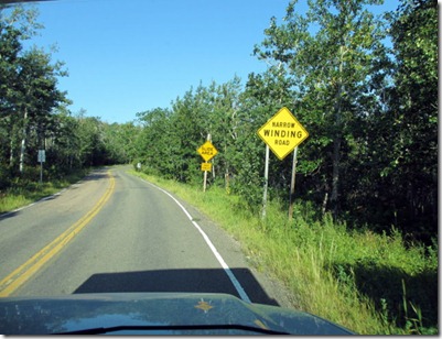 The Aspen trees never get to grow very tall at this elevation, or straight.

 There were lots of spots where the road had washed out with some pretty marginal repairs. My brother Glen would be a little nervous riding on some of these spots.
 Here are a couple of kayakers on Swan Lake which is along MT Hwy 83.
 Upon reaching Lolo we saw that the smoke from the Idaho fires was pretty bad so we decided to drive the RV up to the Lolo Pass Visitor Center and find out how bad it really was. This is some of what we saw on the way.

 We talked to a Park Service employee who said the smoke was worse as you go west. So we decided to skip Hwy 12, which is kind of good as it gives us another reason to come back west. It’s sad to hear that the only probable way these fires will be put out will be by the winter snows.
So it’s a u-turn back into Montana.
We talked to a Park Service employee who said the smoke was worse as you go west. So we decided to skip Hwy 12, which is kind of good as it gives us another reason to come back west. It’s sad to hear that the only probable way these fires will be put out will be by the winter snows.
So it’s a u-turn back into Montana.
 When we got back to Lolo we turned south on US 93 and headed to Hamilton where we spent the night. This is what we saw all the way down. The smoke kept getting thicker.
 I guess now we will head to Yellowstone and the Tetons to see how the smoke is affecting that area.
Before we left Hamilton I washed the windows and noticed that there was soot from the fires on the hood of the RV.
So on Monday the 27th we started our drive from Hamilton to West Yellowstone and came across several old burn areas and all of them had houses. I wonder how many of them had to be rebuilt, although this looks like it was a survivor.
I guess now we will head to Yellowstone and the Tetons to see how the smoke is affecting that area.
Before we left Hamilton I washed the windows and noticed that there was soot from the fires on the hood of the RV.
So on Monday the 27th we started our drive from Hamilton to West Yellowstone and came across several old burn areas and all of them had houses. I wonder how many of them had to be rebuilt, although this looks like it was a survivor.
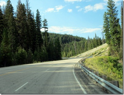
 Once again there was some beautiful scenery on the route we took.
 We stopped at the Big Hole National Battlefield where the visitor center tells of the battle and also a 25 minute film. We are familiar with the basic story of Chief Joseph and the Nez Perce Tribe trying to evade the US Army and get to Canada but were stopped 40 miles short of the border.

 In the center of the picture are teepee poles showing where the Nez Perce were camped. What followed was not a shining point in U.S. history. The soldiers attacked from the scrub brush to the upper left of the camp. This was done on August 9, 1877 at 3:00 in the morning with orders to shoot low into the tents as everyone (women, children and warriors) would be sleeping (on the ground). Of the approximately 75 Nez Perce killed only about 30 were warriors. The rest were women, children and old men. The US Army had 29 dead and 40 wounded out of 163 soldiers and 34 civilian volunteers.
 On our trip today we traveled along 3 major rivers, the Bitterroot, the Big Hole, and the Madison Rivers.
 When driving along the Madison we came to a spot where an earthquake had caused a landslide that closed off the river. I’m going to plagiarize an old blog of ours from August 29, 2008 to tell the story.
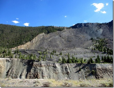
 This area is called the Madison River Canyon Earthquake Area.
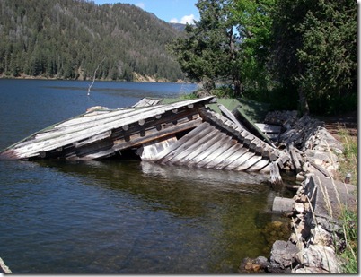
 This earthquake, a 7.5 on the Richter scale and the fourth largest at that time in the US, happened on August 17, 1959 at a little after 11:00 PM. The first area we came to was Hebgen Lake. the Land surface along the north shore of the lake dropped 19 feet causing the lake bed to tip which sent the water sloshing back and forth. Cabins and resorts on the north shore were inundated with water while the south shore was left high and dry. The first building was shaken apart from the earthquake while the second was immersed in water because of the land tilting.

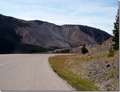
 The most significant event from the earthquake was a major landslide that occurred where over 80 million tons of rock blocked a canyon. This eventually formed Earthquake Lake which now has a depth of over 100 feet where, previously, you could wade across the Madison River at this point.
These are looking at the landslide from the east.
The most significant event from the earthquake was a major landslide that occurred where over 80 million tons of rock blocked a canyon. This eventually formed Earthquake Lake which now has a depth of over 100 feet where, previously, you could wade across the Madison River at this point.
These are looking at the landslide from the east.

 There was a Federal campground at this point with approximately 250 campers. 28 did not survive. One of the amazing facts of this lake is how fast it filled. In less than a month the Corps of Engineers had to cut a 150 foot wide by 15 foot deep channel on the top of the slide to let water out. Then less than a month later they had to deepen it by another 50 feet.
This is our site in Yellowstone Grizzly RV Park. We have a very beautiful site in this commercial park. Also the skies are smoke free, I hope they stay that way for a few days.
There was a Federal campground at this point with approximately 250 campers. 28 did not survive. One of the amazing facts of this lake is how fast it filled. In less than a month the Corps of Engineers had to cut a 150 foot wide by 15 foot deep channel on the top of the slide to let water out. Then less than a month later they had to deepen it by another 50 feet.
This is our site in Yellowstone Grizzly RV Park. We have a very beautiful site in this commercial park. Also the skies are smoke free, I hope they stay that way for a few days.
 Until next time,
Dave and Sandy
Until next time,
Dave and Sandy


